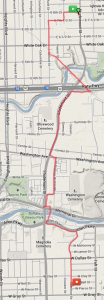
“Pedestrian facilities along Studewood Street are in great condition north of White Oak Drive, but virtually nonexistent along the 4-lane segment of the roadway south of White Oak Drive which includes a 4-lane bridge. However, the use of this segment by pedestrians is evident by foot paths flanking both sides of the corridor. The contra-flow lane confuses drivers who are not familiar with its function, and additional signage could help mitigate this issue. The contra-flow lane also causes problems at major intersection due to the lack of protected lefts. At its northern boundary, the corridor terminates into a 6-legged intersection with E 20th/N Main Street/W Cavalcade Street. The current intersection configuration creates confusion, particularly for the pedestrians and bicyclists to navigate.”
This is the “Identified Needs” of Studewood in the recently completed Heights-North Side Sub-regional Mobility Study. It’s quite comprehensive. See Chapter VI for a listing of many of the streets. What does is say about the ones you care about?
The Michigan U-turn was a new one to me. An alternative to a left turn. See Chp 5, pg 60 for an explanation.
Also, Chp 5, pg 61 has a diagram of a roundabout next to an arial photo of the 20th/Main/Studewood intersection. To this I say YES, YES, YES!
The report is nicely and simply designed and written. Whether it address what you wanted it to is another question.
